// Case study / Research infrastructure
EUFGIS.
A European platform for the conservation of forest genetic resources.
EUFGIS is the European Information System on Forest Genetic Resources, a platform that collects, organizes and makes scientific data from across Europe accessible.
We have been working with the European Forest Institute on EUFGIS since 2009. As part of the European FORGENIUS project, we contributed to a major evolution of the platform, redesigning its architecture and developing new tools for data management, research, geospatial analysis and collaboration between researchers and National Coordinators.
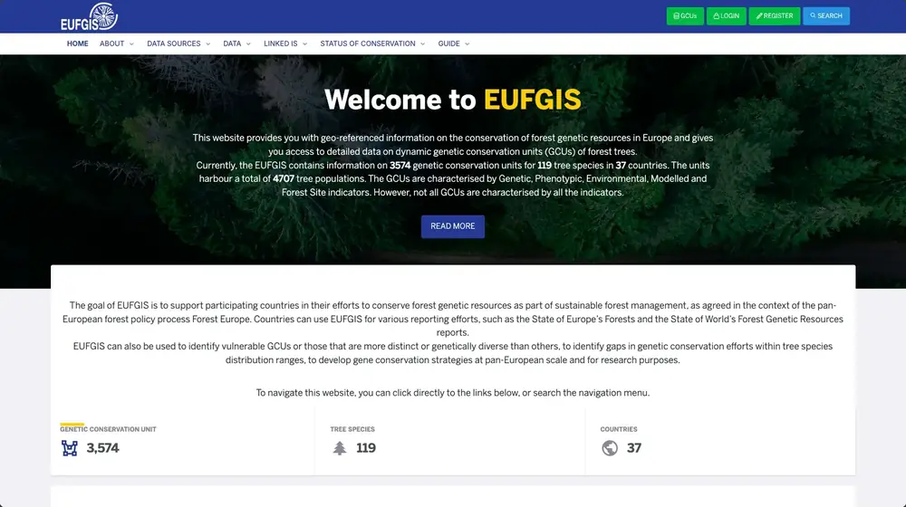
The public home page: geo-referenced information on forest genetic resources, with direct access to conservation units, search and registration.
The public map: the conservation units of the platform appear as points across Europe, with the map attribution visible.
The units overview: totals for units, countries, tree species and populations, with summary tables by country and by species.
The indicator catalogue, grouped into five families: environmental, phenotypic, genetic, modelled and forest. Each family opens its own data view.
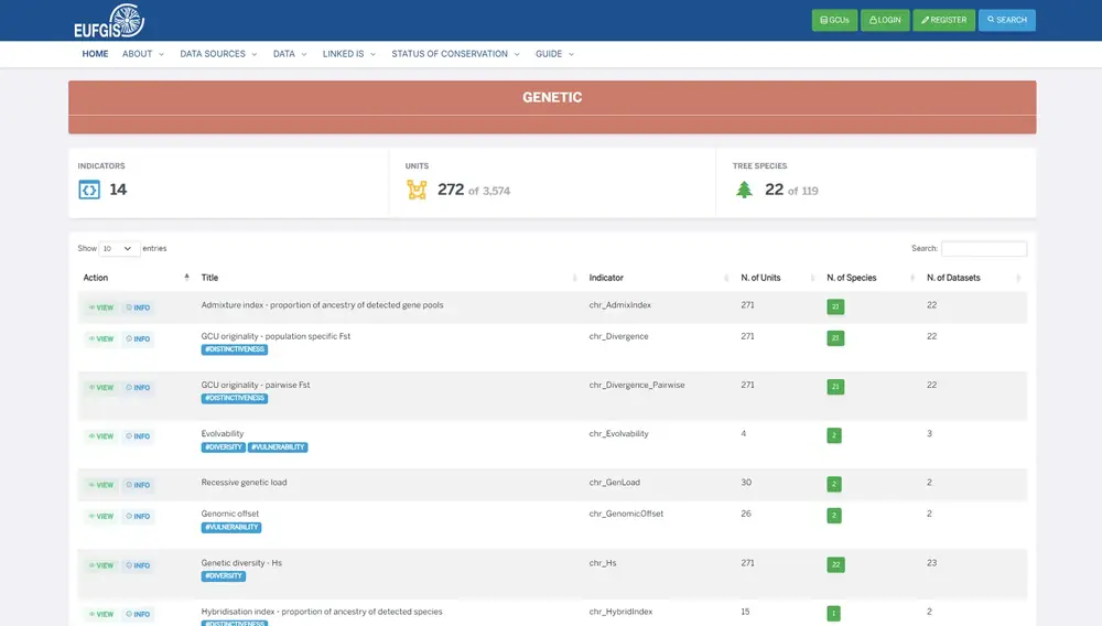
The data view of one indicator family, here genetic: each indicator is listed with its code and tags, and with how many units, species and datasets it covers.
Country-level overviews of the status of genetic conservation, covering dynamic in situ and ex situ measures, with charts of conservation strategy and dynamic conservation effort over time.
// The result
One platform in which information can be followed from contribution to validation, analysis and public use, in public, authenticated and scientific environments.
All outcomes →The challenge
Connecting data, people and tools.
Forest genetic resources involve many different types of information. Each Genetic Conservation Unit (GCU) includes geographical data, species, environmental conditions and management information. Research projects add further datasets, often collected using different methods and tools.
The challenge was to build a system capable of organizing and connecting all this information while preserving its reliability, traceability and scientific meaning.
The platform needed to meet several requirements:
- Make reliable, up-to-date scientific information accessible to the public.
- Provide National Coordinators with tools to create, update and validate conservation unit records.
- Enable research teams to contribute and manage structured scientific datasets.
- Ensure data traceability by managing provenance, versions, permissions and publication status.
- Connect conservation units with maps, climate data and environmental information.
- Organize information from different sources while preserving its scientific meaning.
- Keep the platform flexible and maintainable as new datasets, tools and external services are introduced.
Approach
One platform, multiple working environments.
EUFGIS was designed as a platform made up of different but interconnected environments, each serving specific functions and users. Together, they support the entire data lifecycle, from collection and validation to integration, analysis, publication and reuse.
VISITORS · RESEARCHERS
Public Portal
maps · search · species
NATIONAL COORDINATORS
National Coordinators' Intranet
records · geometries · validation
RESEARCH TEAMS
Characterization Data
datasets · metadata · access rules
Layered information architecture
permissions · publication rules · structured vocabularies
Climate and environmental sources
WorldClim · CHELSA · European Drought Observatory · Sentinel-2 · ERA5-Land
Linked systems
FOREMATIS · GD²
Workflows
Designing around people and processes.
Each user group has different needs and ways of working. That's why we started by analysing scientific and operational processes, designing tools that support the everyday activities of people using EUFGIS.
For National Coordinators, we developed tools to create and update records, edit geographical data, manage validation and control publication. For research teams, we built tools to collect and organize different types of scientific datasets while preserving the information needed to interpret them. For the public, we designed search interfaces and interactive maps that make complex information easier to access and explore.
We also defined roles, permissions and publication workflows to ensure that data can be edited and validated in restricted environments before being made available through the public portal.
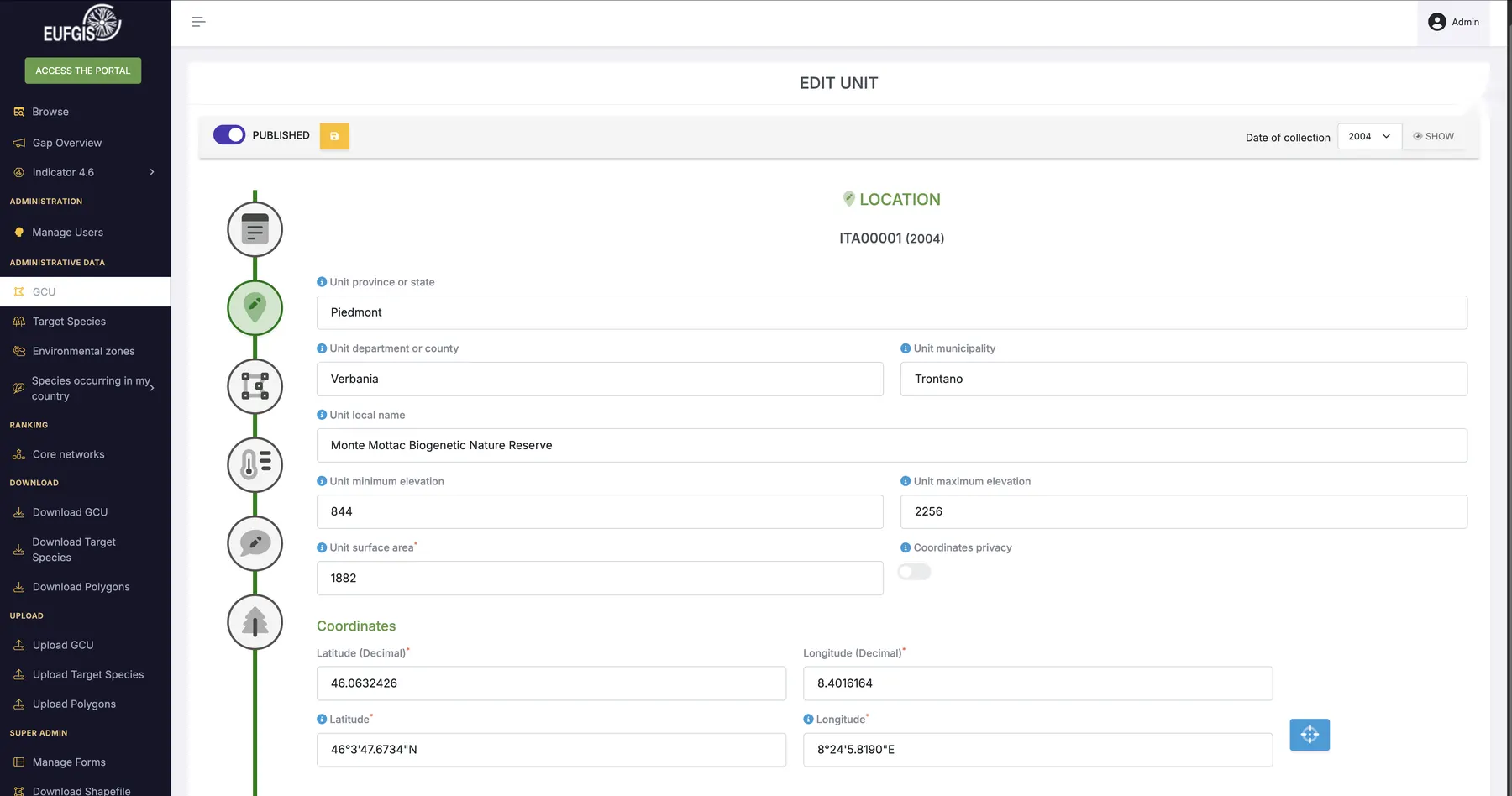
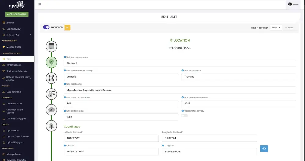
A guided form
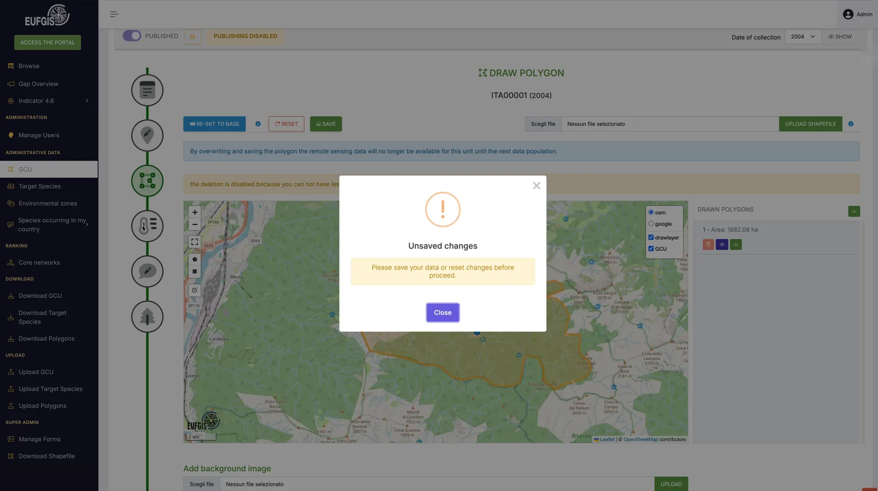
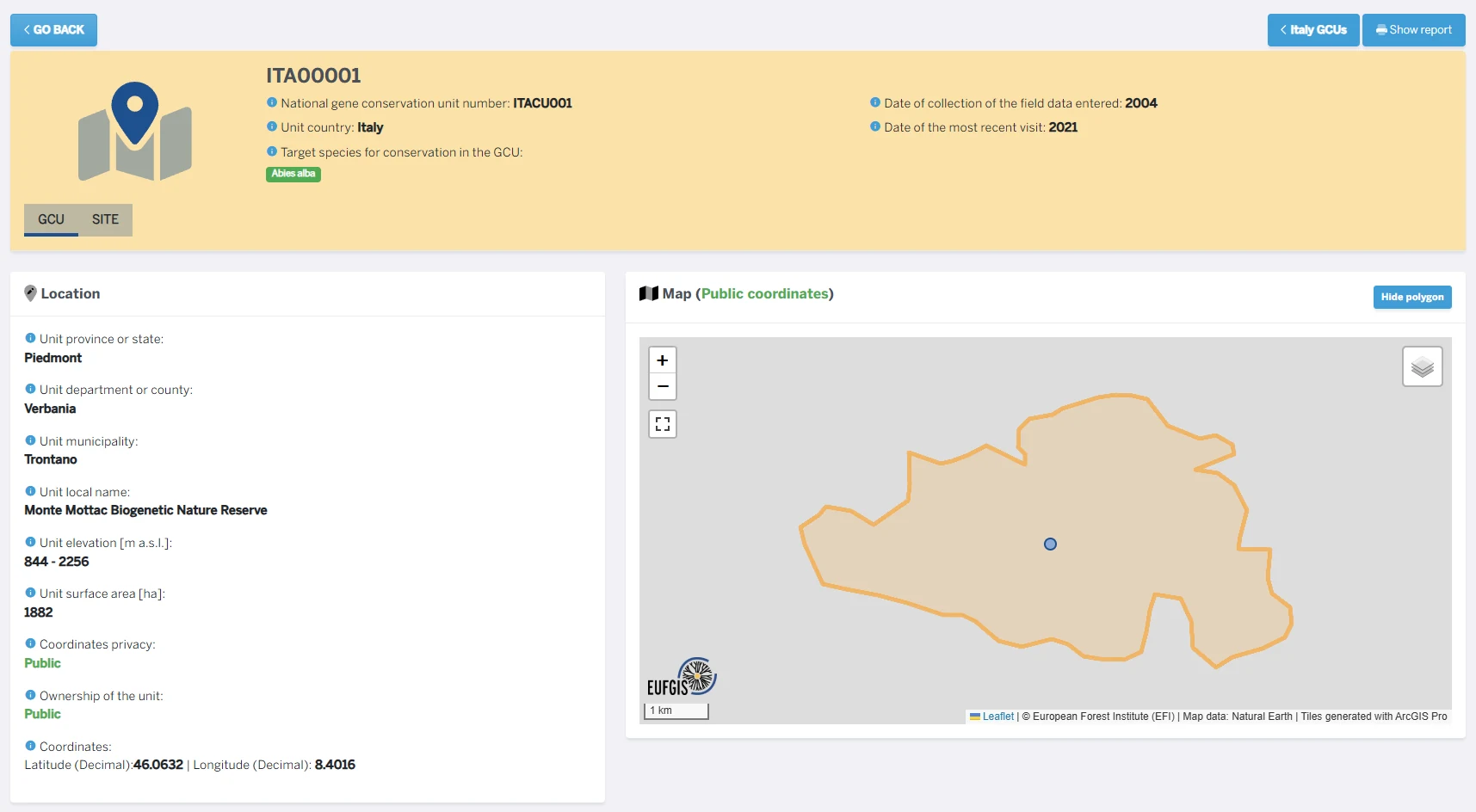
National Coordinators work on one record at a time. A vertical stepper leads through identification, location, polygon, climate, remarks and species. Here, the location section of a unit.
Protect the record
The form guards the integrity of the record. While changes are unsaved, users must save or reset before moving on, and publishing is disabled.
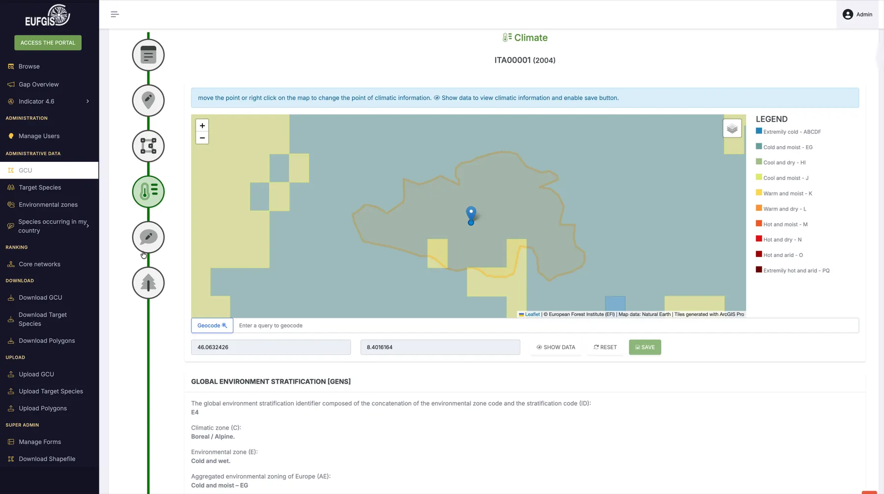
Climate at the unit location
The climate section places the unit on an environmental stratification map and shows climatic information for the chosen point, with its legend and source attribution.
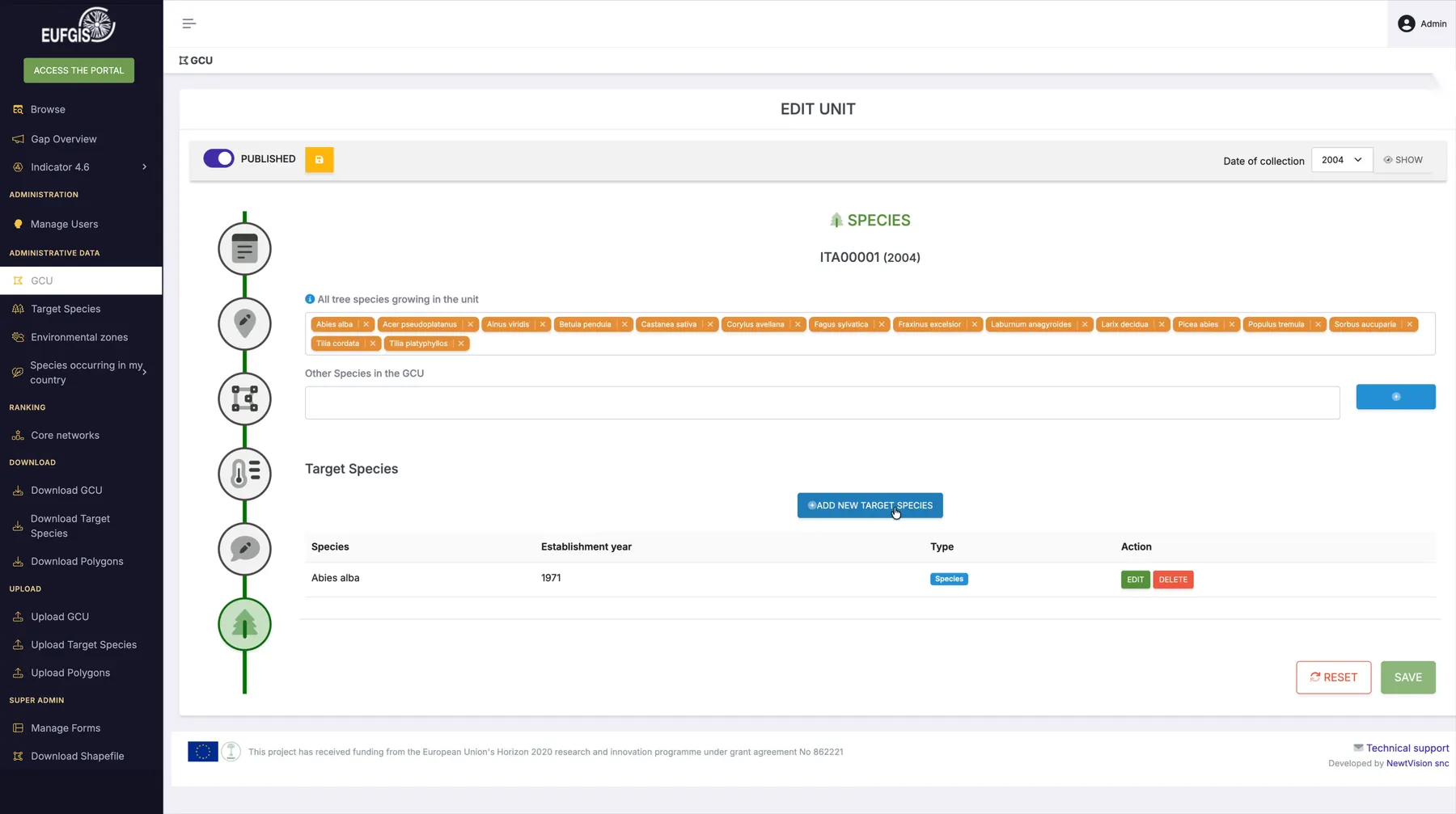
One switch per unit
Each unit carries its own publication switch, next to save and the date of collection. Species and target species are managed in the same record.
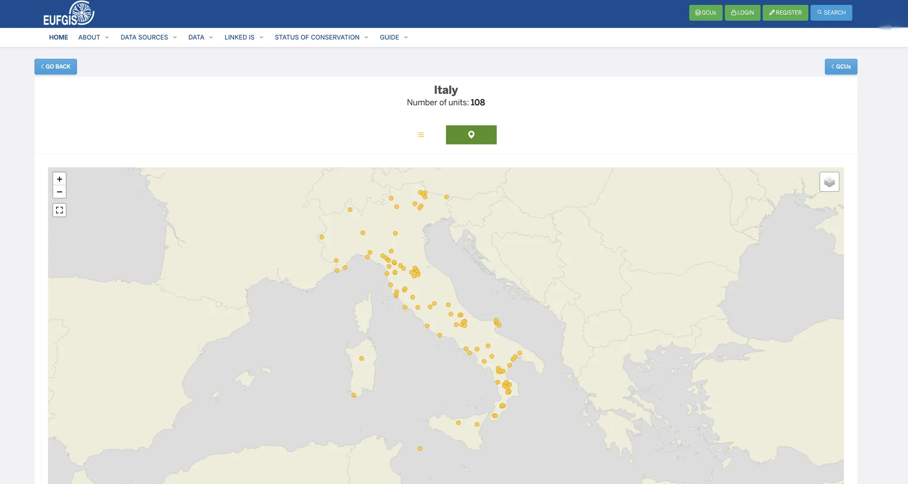
The public view
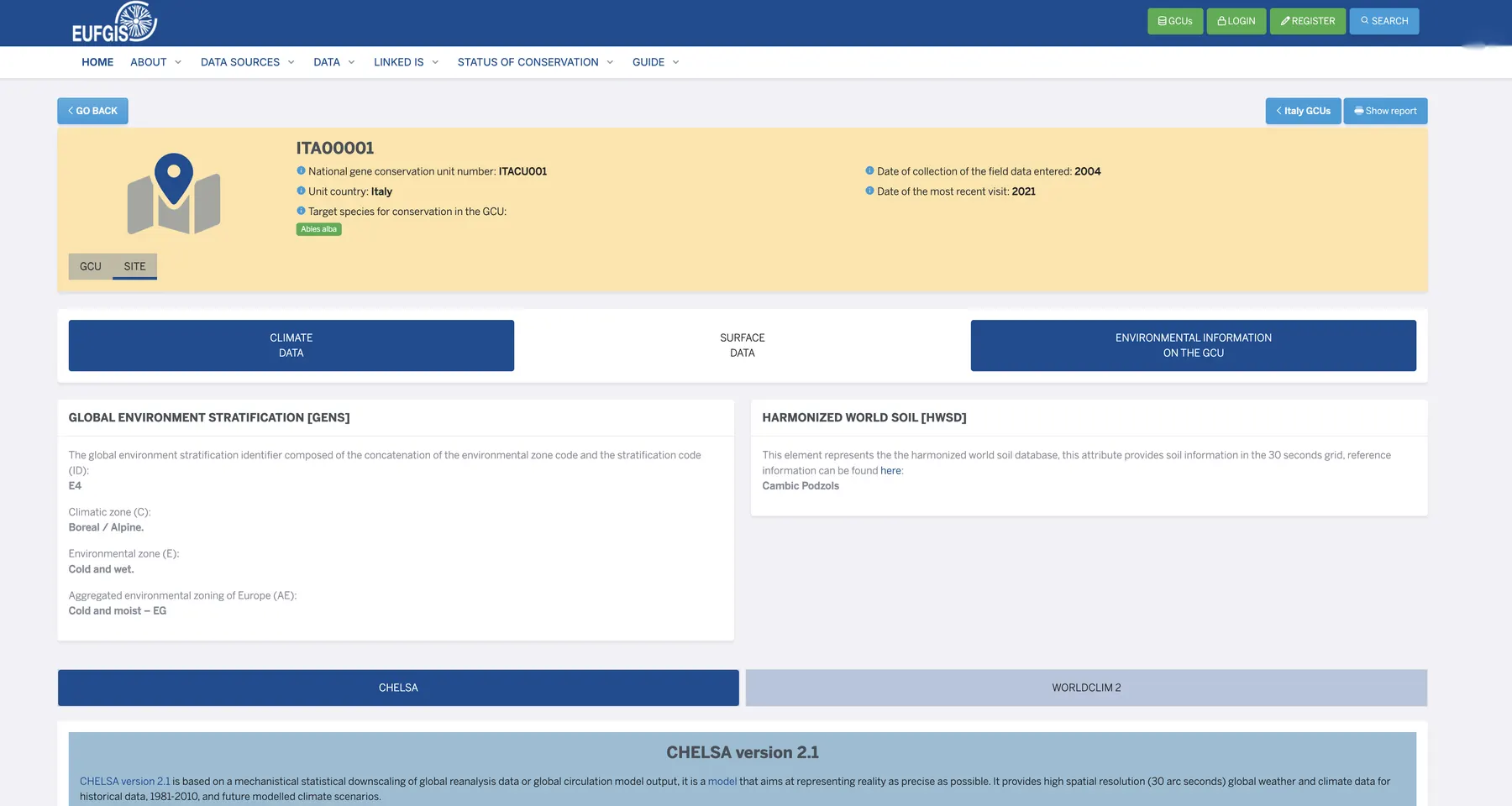
Once published, a unit appears on the public portal. A country page lists and maps its units, here Italy, and each unit has its own record with environmental data.
// Select a step
Not every dataset follows an identical path: several steps include human validation.
Geospatial
Geospatial tools built into the work
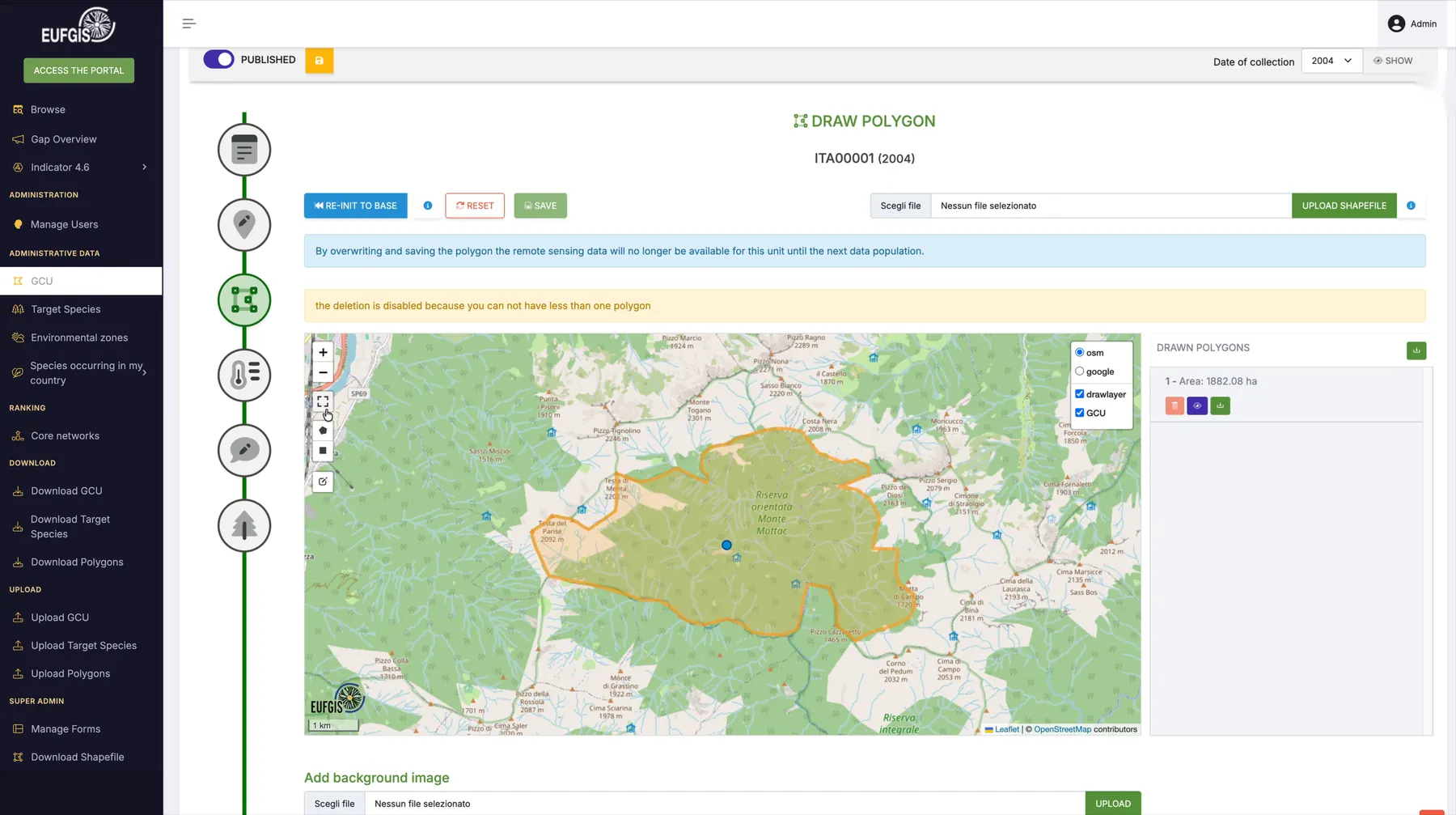
Geographical location plays a fundamental role in the conservation of forest genetic resources. That's why we integrated geospatial tools directly into the platform, making maps an essential part of data management and analysis.
Authorised users can create and edit geometries, draw polygons and multipolygons, and import geographical data, including shapefiles. Each conservation unit can be linked to its geographical area and the associated climate and environmental information.
These tools allow users to manage and analyse geographical information without relying on external applications. On the public portal, interactive maps make it possible to explore conservation units, while restricted environments provide additional features for editing and validating data.
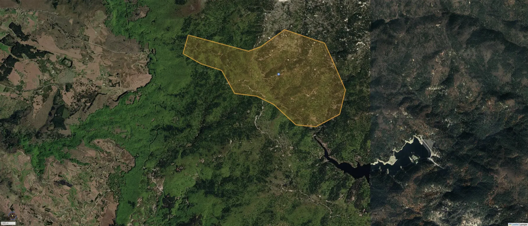 Conservation unit geometry
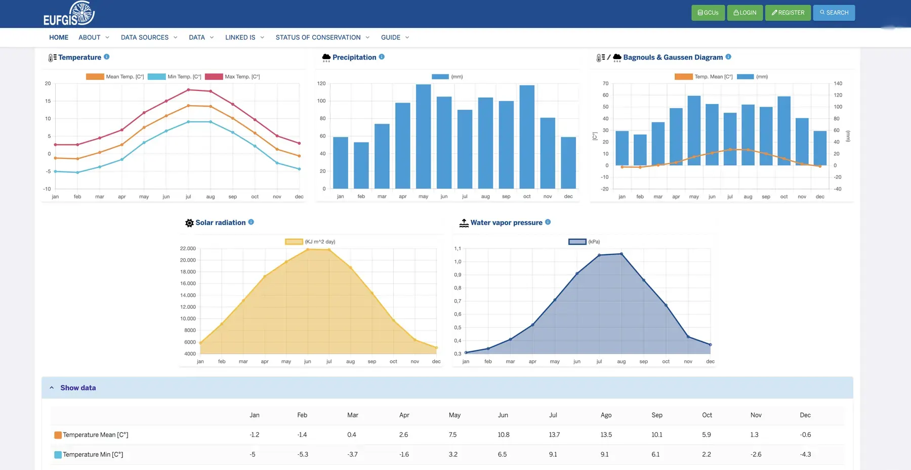
Environmental data
Integrating climate and environmental data.
Understanding the environmental conditions of a given area is essential for studying and conserving forest genetic resources. That's why EUFGIS connects conservation units with climate data, environmental information and satellite observations from different scientific sources.
We developed tools to associate geographical areas with climate and environmental indicators, integrating external services and data processing workflows. The platform also supports information derived from sources such as Sentinel-2 and ERA5-Land, providing further insights into the environmental characteristics of each area.
Data is organized and made available alongside information about its sources, allowing researchers to interpret it correctly and use it in their analyses.
Data architecture
Organizing complex data and its relationships.s
EUFGIS manages different types of scientific information, connected through relationships and classifications. To organize this information, we designed an architecture that combines different technologies, each serving a specific purpose.
ArangoDB manages data related to Genetic Conservation Units and target species. Its document and graph capabilities allow us to model relationships between species, geographical areas, classifications and other scientific concepts, preserving the connections between different types of information.
MySQL and TYPO3 support application functionality, content management and data access through the public portal and restricted environments. This architecture preserves the complexity of scientific information while making it accessible through search tools, detailed records and analysis features.
The platform is also designed to communicate with external systems such as FOREMATIS and GD², using shared identifiers, vocabularies and data integration processes to maintain consistency and traceability across different sources.
ArangoDB
- GCU and target-species documents
- graph relations and classifications
- structured data dictionary
MySQL + TYPO3
- application configuration
- materialised views
The graph supports the relationships; materialised views support operational and public-facing functions.
// Select a part of the record to magnify it
// Linked information systems
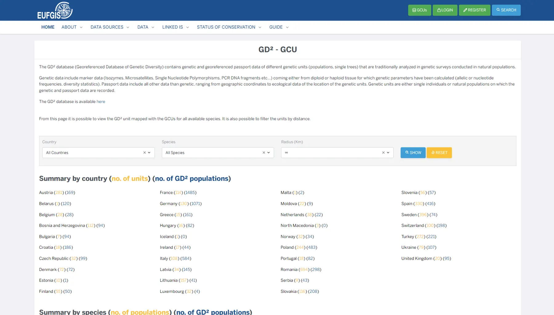
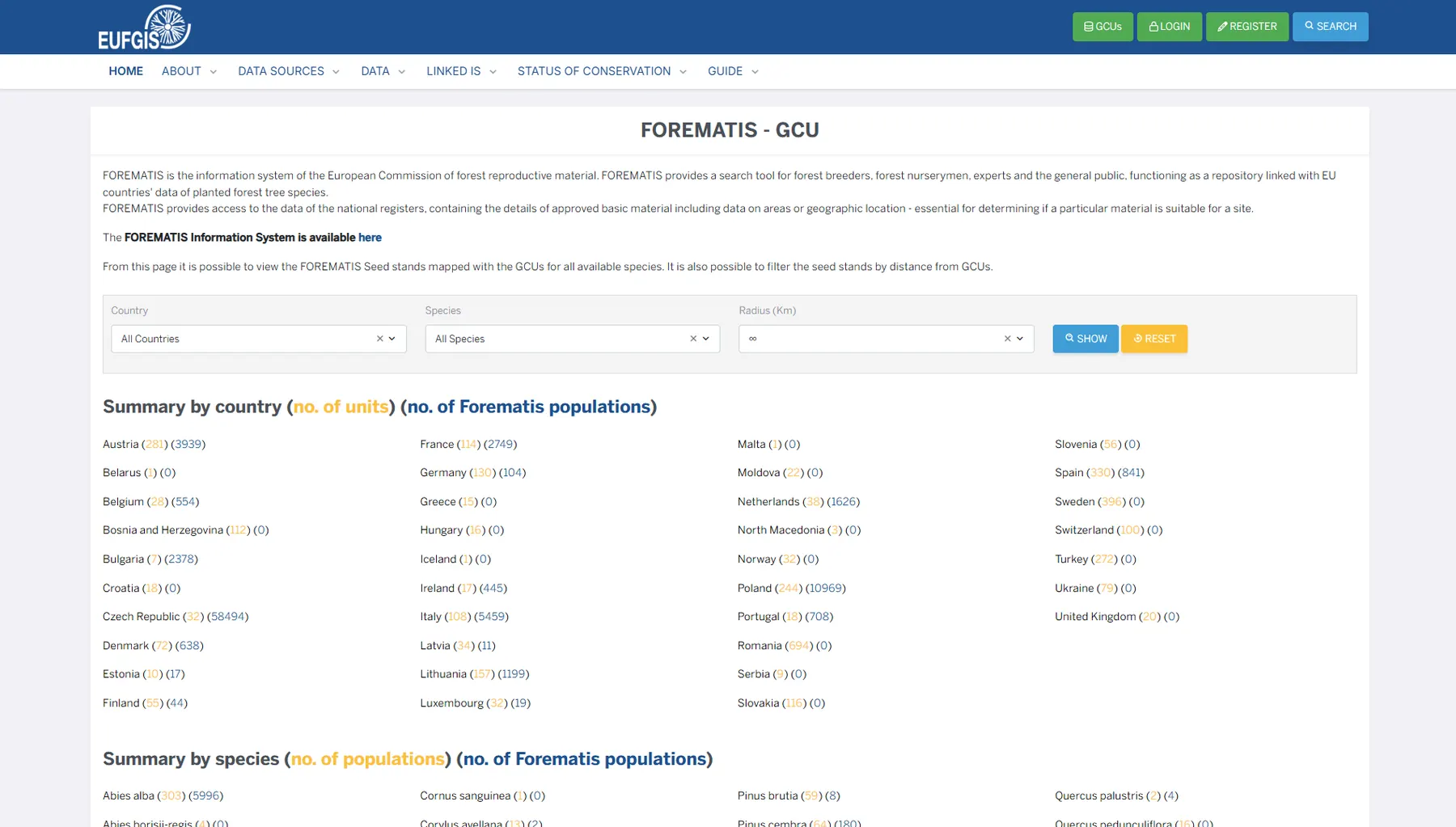
From the public portal.
Continuity
A project that grows over time.
EUFGIS is a platform that continues to evolve. Over the years, research needs have changed, the amount of available data has grown, and new tools and features have been introduced. Each development has required integrating new solutions while preserving existing information and ensuring service continuity.
We have been working with the European Forest Institute on EUFGIS since 2009. This long-standing collaboration has given us a deep understanding of the platform, its users and the scientific processes it supports, allowing us to guide its evolution across different projects and technologies.
Our work covers both the design and development of new features and the ongoing maintenance and improvement of the infrastructure, with particular attention to security, performance and the ability to adapt to changing requirements.
Scope of our work
- Requirements analysis and software architecture design
- Information architecture and UX/UI design
- TYPO3 application development and customisation
- Data modelling and ArangoDB/MySQL integration
- Geospatial tools and interactive map development
- External API and dataset integration
- Authentication, permissions and publication logic
- Performance, maintainability and technical evolution
- Deployment support and long-term collaboration
"The goal was to build a platform capable of organizing, connecting and making complex scientific data accessible, turning it into useful tools for research and the conservation of forest genetic resources."
Outcomes
What we built.
Our work brought tools, data and scientific processes together in a single platform, simplifying information management and collaboration between different user groups.
From data collection to publication
A structured workflow for creating, validating and publishing data, with clearly defined roles and permissions. Information is managed in restricted environments before being made available through the public portal.
See the workflowIntegrated maps and environmental data
Tools to create and edit geometries, explore conservation units and connect them with climate and environmental information, directly within the platform.
See the geospatial toolsConnected scientific data
An environment for organizing datasets from different research fields, preserving metadata, access permissions and relationships with species and conservation units.
See the ecosystemIntegration with external systems
An architecture that connects EUFGIS with other scientific platforms through identifiers, shared vocabularies and data integration processes.
See linked systemsA platform that keeps evolving
A modular architecture that supports new features, data sources and research tools while ensuring service continuity and building on the work carried out over the years.
See the continuity approachOur approach
The decisions that matter.
-
01
Start with data, not interfaces.
In a scientific platform, how data is organised determines what the system can do. Defining structures, relationships and classifications from the start helps build more reliable and adaptable tools.
-
02
Listen to the people using the tools.
National Coordinators and researchers understand the processes and challenges of their work. Involving them in the design process helps us develop features that address real needs rather than forcing their activities into generic tools.
-
03
Keep working data separate from published data.
Not all information is ready to be shared immediately. Roles, permissions and validation workflows support collaborative data management while maintaining control over what becomes publicly available.
-
04
Design systems that work together.
Connecting different platforms requires more than technical integration. Identifiers, shared vocabularies and update rules must be carefully designed to keep information consistent and meaningful across systems.
-
05
Think beyond the project's lifetime.
Research funding has defined timelines, but platforms need to keep working and growing. Maintainable architecture, clear documentation and regular updates help preserve existing work and support future needs.
Why it matters
Why this project matters to us.
EUFGIS reflects the way we work: understanding complex problems, collaborating with the people who deal with them every day, and designing tools that make data, information and processes easier to manage.
It's a project that brings together scientific research, software architecture, data management and web development. Above all, it represents a collaboration that began in 2009, built on mutual understanding, ongoing dialogue and the ability to evolve a platform alongside the needs of its users.
For us, that's what makes a project successful: building something that works today and continues to be useful over time.
// Next step
Have a complex project in mind?
We work with research organisations and institutions to design and develop web platforms, data management systems and custom digital tools. If you're facing a similar challenge, let's talk.
info@newtvision.com · +39 06 55 60 305